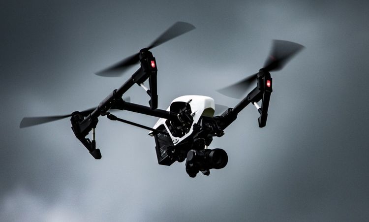
Drones have exploded beyond amateur photography into serious commercial workhorses. Most folks still picture drones snapping beach photos or wedding videos. Sure, they excel at that, but these flying robots now tackle deadly power line inspections, monitor endangered wildlife, and even save lives during disasters. The tech keeps improving at a crazy pace. Newer models fly longer, carry heavier gear, and practically fly themselves. Let me walk you through the main applications of drones.
Power Inspection

Utility companies used to inspect power lines by sending workers up towers or hiring helicopters. Talk about expensive and dangerous. Now, they fly drones instead. I recently chatted with a utility director who completely revamped their inspection process. His team uses specialized drones that spot overheating transformers with thermal cameras. They detect tiny problems invisible to human eyes.
The math is simple. Helicopter inspections cost about $1,200 per mile. Drones? Roughly $200. Plus, no human dangling from a helicopter hundreds of feet up. One power company cut inspection time from three weeks to four days after switching to drones.
Efficiency in Power Grid Maintenance
The drone revolutionized utility crew operations to maintain power infrastructure. The unmanned aircraft system speeds through transmission lines to detect loose connections, damaged insulators, and wildlife-caused disruptions.
Drone inspections conducted continuously help prevent power outages from occurring beforehand. The drones detect a failing connector that would have disconnected power to thousands of customers, so the repair team arrives to fix it before any power outage occurs.
Traffic Monitoring
The combination of rush hour congestion and driving myself causes me headaches. I need to estimate how much work time is lost due to traffic delays. Traffic cameras offer limited assistance by remaining stationary and failing to capture the whole situation.
Drones offer a different solution. Police departments deploy drones to track traffic congestion areas and then move vehicles after road incidents occur. The aerial drone perspective enables the detection of gridlock problems while these issues are still developing.
One of my transportation-managing buddies in Denver uses drone technology during major events. The drone program allows traffic authorities to detect upcoming congestion and automatically modify signal control systems, reducing travel times across the network by 20%.
Advanced Traffic Analysis Systems
Drones gather traffic data that serves various long-term purposes in addition to instant decision-making. Cities implement aerial drone footage connected to AI operative systems to detect design-related issues and traffic patterns throughout the infrastructure.
The weekly assessment of traffic flow modifications during construction projects replaces obsolete traffic modeling techniques. Engineers base their modifications to work zones on actual field observations instead of theoretical calculations.
Environmental Protection
The conservation work required staff to walk through difficult terrains with minimal drone coverage while disturbing wildlife populations. Drones changed all that. Drone operators with thermal imaging cameras provide extensive poacher surveillance of large protected areas. These devices can detect trespassers from great distances at night. Implementing drone surveillance systems in African parks has decreased poaching activities by more than 30%.
Wildlife Conservation Efforts

Helicopter-based population tracking methods stressed the wildlife population researchers were trying to protect. Drones operate at greater heights and provide quieter flights to collect exact information without causing disturbances to the wildlife.
According to an interview with a wildlife biologist, using drones for elephant censuses enhanced census accuracy by 23%. The mothers with calves did not exhibit any stress behaviors that helicopter surveys typically produce.
Special-purpose drones can identify diseased animals within animal populations through their unique camera systems. Rangers detect contagious diseases and treat them before they spread to defenseless populations. The early identification of endangered species through intervention has prevented multiple species from being wiped out by outbreaks.
Confirmation of Rights
Property disputes cost millions in legal fees and delayed projects. Traditional land surveys take weeks of field work and mountains of paperwork.
The precision is remarkable. Modern survey drones measure distances within centimeters, creating irrefutable evidence for property lines. Cases that once dragged through courts for years now resolve in days with clear aerial documentation.
Property Mapping Advantages
When discussing property mapping, drones create incredibly detailed 3D models that reveal features invisible from ground level. Developers see how water flows across land during rainstorms, identifying drainage issues before breaking ground.
Insurance companies use similar drone surveys after storms. Adjusters get roof damage reports without climbing ladders, processing claims faster and more accurately than ever.
Agricultural Insurance
Farmers face huge risks from weather, pests, and market fluctuations. When disaster strikes, traditional crop insurance claims move at a frustrating pace.
Before drones? The process typically took weeks, with adjusters walking small sections of fields and extrapolating damage estimates. The room for error was enormous.
Crop Damage Assessment
Drone assessment dramatically standardizes crop insurance claims. Drones capture consistent imagery across entire operations regardless of field size or terrain challenges.
The multispectral cameras spot damage beyond what human eyes detect. They identify crop stress from insects, disease, or weather through subtle color variations invisible to adjusters on foot.
This technology also prevents fraud. Historical drone footage proves when the damage occurred and its true extent. Both farmers and insurance companies benefit from the clear, time-stamped evidence these aerial surveys provide.
Post-Disaster Rescue
Natural disasters require immediate response during every passing minute. Searching damaged areas through traditional methods with ground teams remains slow and tedious.
The rescue teams operating thermal drones located seven survivors hidden beneath rubble after the 2020 Tennessee tornado. The search duration was reduced from days to hours, which every survivor attributed to their survival.
Emergency personnel activate drone fleets immediately to respond to hurricanes, earthquakes, and floods. The team performs building inspections and tracks survivor locations while safely guiding teams to destinations that need immediate attention.
Allocation of Rescue Resources
After disasters strike, determining the optimal locations for sending scarce rescue teams is the main difficulty. Drones' essential overview capability enables these critical decisions.
A California fire department chief demonstrated how aerial drones could survey a whole wildfire perimeter within 40 minutes, a task that would have required ground teams to spend days on. The information gathered enabled authorities to evacuate areas under direct fire threat and reassure other communities about their evacuation time.
Drone technology provides vital information about safe rescue boat paths and bridge structural integrity to assist flooding rescue operations. The provided intelligence has saved both rescuers and their lives numerous times.
Remote Sensing Surveying and Mapping
Construction projects lived or died by survey quality long before drones arrived—traditional methods required weeks of field work and complicated equipment.
Now, drone surveys capture millions of data points in hours. A construction manager I work with scheduled a drone survey of a 15-acre development site on Monday and received detailed topographic maps by Wednesday. The previous method would have required three weeks.
Drone methods actually improve accuracy. 3D photogrammetry creates models accurate to within centimeters, capturing every slope, tree, and existing structure on the property.
3D Mapping Applications
These 3D drone maps have applications far beyond basic surveys. Urban planners use them to visualize how new developments affect neighborhoods before approval. The models show sightlines, shadows, and traffic impacts with incredible realism.
Architects overlay designs onto these models during client presentations. I watched a commercial client's eyes light up when they saw their future building in perfect context with surrounding properties. The visualization sold the project instantly.
Mining operations use similar drone mapping to calculate exact material volumes and plan extraction sequences. The efficiency gains from this precise planning often exceed 20% compared to traditional methods.
Forest Fire Protection

Wildfires devastate millions of acres annually. Traditional detection relies on fire towers and public reports, both of which typically spot fires only after they've grown substantial.
Modern forestry departments patrol high-risk areas with thermal drones during dangerous conditions. They detect hot spots before visible flames appear. One Western state reported catching 84% of fires while still smaller than a tennis court after implementing drone patrols.
The early intervention advantage saves millions in firefighting costs and prevents ecological devastation. Small fires require minimal resources to extinguish.
Fire Detection Systems
The most impressive systems combine autonomous drones with AI detection algorithms. These drones fly predetermined routes through forests, requiring minimal human oversight.
When California integrated this technology in three high-risk counties, the average fire size was reduced by 71% in the first season. The drones spotted fires an average of 17 minutes after ignition versus 1.5 hours with traditional methods.
During active fires, different drone models map the fire perimeter hourly, helping incident commanders predict spread patterns and position resources. This real-time intelligence prevents firefighter deaths and protects nearby communities.
Conclusion
Drone applications have moved from gimmicks to essential tools across dozens of industries. Over the past decade, I've personally watched them transform workflows, cut costs, and save lives.
The technology keeps improving at breakneck speed. Battery life doubles roughly every four years. Sensors get lighter and more capable every season. Software makes operation increasingly accessible to non-pilots.
Your industry has drone applications you haven't considered yet. The competitive advantages these flying robots provide will only grow more significant. The question isn't whether drones can help your business – how quickly you'll adopt them before competitors do.
Also Read: Top Air Conditioning Companies in Missouri for Quality HVAC Services


